 Catalogue PIGMA
Format
ESRI Shapefile
Type of resources
Available actions
Topics
Keywords
Contact for the resource
Provided by
Years
Formats
Representation types
Update frequencies
status
Scale
Resolution
From
1
-
10
/
1160
-
-
Cartographie historique des écluses à poissons présentes sur l'île d'Oléron.
-
-
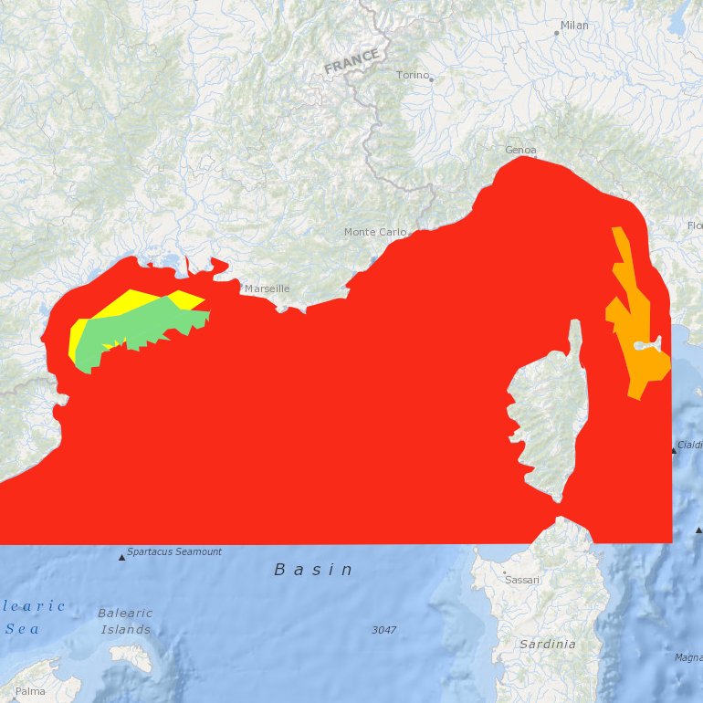
Suitability index of a wind farm in the NWMed concerning the environmental resources, the natural barriers, human activities, MPA and fisheries.
-
-
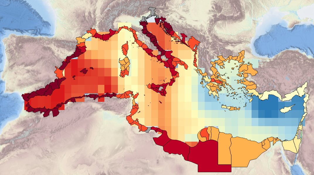
Description of the spatial layers atributes of sea surface temperature trend for the last 10, 50 and 100 years for the Mediterranean basin and for each NUTS3 region along the coast.
-
-
to deliver maps showing the extent of the trawling fishing grounds for identifying the areas which are most disturbed by bottom trawling over the past ten years and identifying the gaps of fishing vessels’ tracking systems in the Mediterranean Sea
-
Combination MPAs and monitoring stations for biodiversity elements
-
