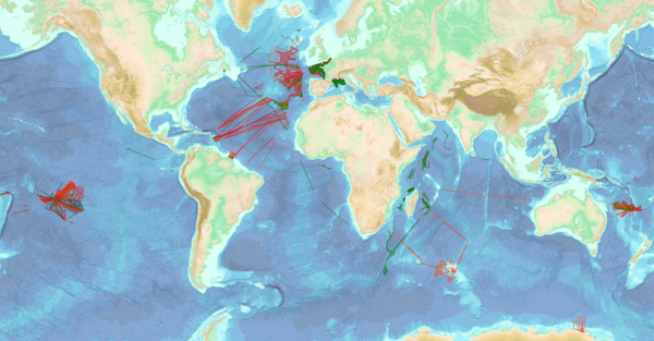
 Catalogue PIGMA
Shom
Type of resources
Available actions
Topics
Keywords
Contact for the resource
Provided by
Years
Formats
Representation types
Update frequencies
status
Scale
Resolution
-
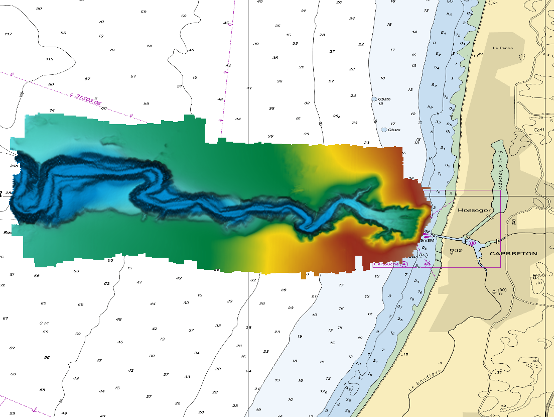
The DTM is a compilation of multibeam echosounder surveys acquired in 2013. The resolution is 1/64 arc-minutes (~30m). Surveys are located on the Capbreton Submarine Canyon (France) with depths from -4.7m to -344.9m. Depths are referenced to the Lowest Astronomical Tide and the coordinates are expressed into the WGS84 reference frame. The surveys which compose the DTM are S201306500-09 and S201306500-11. Data and metadata associated to these surveys are available on the website http://diffusion.shom.fr/pro/lots-bathy.html. The DTM is not to be used for navigation.
-
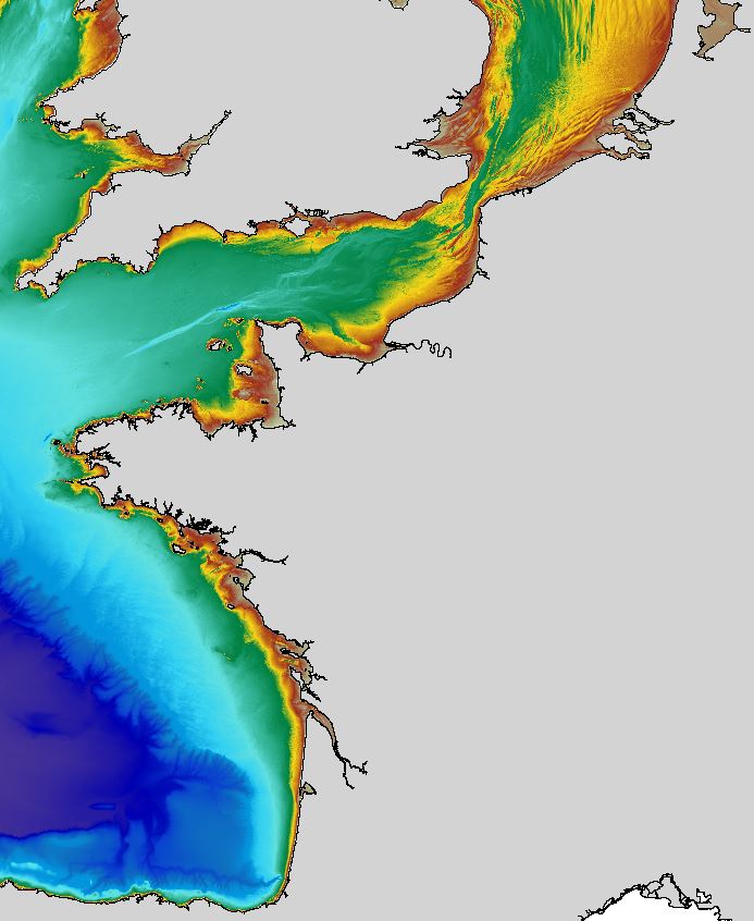
The regional bathymetric Atlantic – Channel – North-Sea DTM has a resolution of 0.001° (~111m). Its geographic coverage includes the Bay of Biscay, the English Channel and a part of the North Sea. The DTM extends from the coast to the continental slope (about of 4800m deep). This DTM is produced in the framework of the HOMONIM project which aims at improving operational forecast capabilities for the national coastal flood warning system. This DTM is offered openly on the Shom diffusion website (http://diffusion.shom.fr/produits/bathymetrie/mnt-facade-atl-homonim.html). http://dx.doi.org/10.17183/MNT_ATL100m_HOMONIM_WGS84
-
Shom is the national referent for the level of the sea in situ on all areas under French jurisdiction. In this capacity, he assures under the acronym REFMAR different coordination functions in the collection and dissemination of public data related to water level observations, in order to promote their use in multiple applications within the framework of international recommendations.
-

The georeferenced digital image solution for the nautical chart is a digital conversion of the corresponding printed nautical chart produced by Shom or its legends, with georeferencing indications and including miscellaneous text.
-

The coastal topobathymetric DEM of Ré Island's surroundings, with a resolution of 0.00005° (~5 meters), was created by Shom as part of the HOMONIM-3 project. It covers the coast of the municipalities of Ars-en-Ré and Saint-Clément-des-Baleines, extending offshore to a depth of about 20 meters, to the west of the Phare des Baleines lighthouse. This DEM is designed for use in hydrodynamic models to enhance the modeling of coastal processes, particularly forecasting submersion risk. The product complements the coastal topobathymetric DEM of the Pertuis-Charentais, with a resolution of 0.0002° (~20 meters), and the bathymetric DEM of the Atlantic coast, with a resolution of 0.001° (~100 meters). It is available in the vertical reference of the Lowest Astronomical Tide (LAT) or the Mean Sea Level (MSL).
-
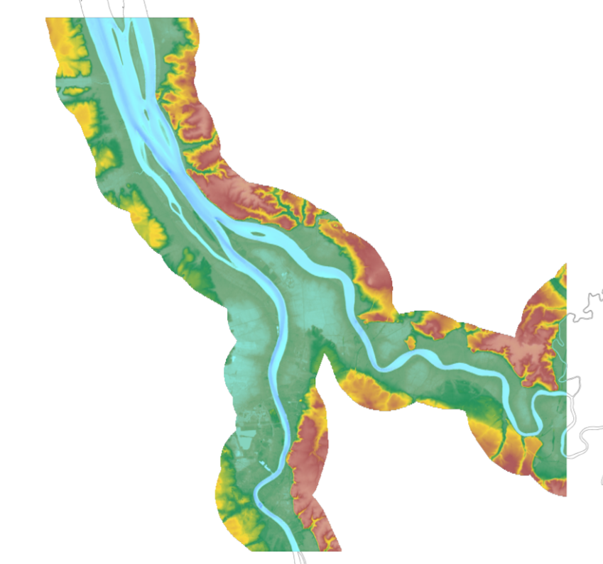
The update of the coastal topo-bathymetric DEM of the Gironde estuary - upstream with a resolution of 0.0002° (~ 20 m) was carried out in the third phase of the HOMONIM project. This DEM covers the upstream part of the Gironde estuary, from Pauillac to Bordeaux on the Garonne and to Libourne on the Dordogne. It is complementary to the DEM covering the downstream estuary (between Pauillac and the mouth of the Gironde). The DEM is intended to be implemented in hydrodynamic models in order to produce forecasts as accurate as possible of water heights and sea states at the coast to improve the relevance of the Wave-Submergence Vigilance. This product is available with either the Lowest Astronomic Tide (LAT) or the Mean Sea Level (MSL) as a vertical reference.
-

The product "BathyElli surfaces v2.1" contains the surface realisation of the ellipsoidal height at the reference date of 1 January 2000 of the characteristic tidal levels corresponding to : - Highest Astronomical Tide (HAT): "BathyElli v2.1 HAT / ell" ; - Mean Sea Levels (MSL): "BathyElli v2.1 MSL / ell"; - Lowest Astronomical Tide (LAT): "BathyElli v2.1 LAT / ell"; - Chart Datum (CD) vertical sea level reference for each tidal zone: "BathyElli v2.1 HZ / ell".
-
Bathymetric datasets are an extraction of surveys belonging to the Shom public database. For depth up to 50m, the vertical precision of soundings varies from 30cm to 1m and the horizontal precision varies from 1 to 20m. In deep ocean, the vertical precision is mainly around 1 or 2% of the bottom depth. It is sometimes more, it depends on the technology used. The data are referenced to ZH which is assimilated to LAT. Data are corrected for sound velocity variations. <br /> October 27 2025 version
-
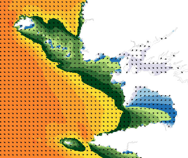
Wave forecasting models allow the representation of sea states based on a spectral resolution at the global scale or at the scale of ocean basins. This code calculates the evolution of the sea state by decomposing it into a wave spectrum that propagates in different directions and with different periods. During the propagation, the wave energy is increased or decreased by the effects of wind, breaking waves and energy exchanges between the different components. The wave forecasts available on data.shom.fr are calculated with 2 different types of models: MFWAM for the offshore domain (resolution from 0.5° to 0.1°) and Wavewatch III ® (WW3) for the coastal domain (resolution from 2' to 200m). MFWAM is a sea state forecasting model (wind wave and swell) derived from the third generation WAM code (WAMDI Group, 1988). Wavewatch III ® (WW3) is developed in a collaboration between the United States Weather Service (NOAA/NCEP), Shom, the University of Darmstadt in Germany, and other partners. The forecasts published on data.shom.fr are issued from the parameterization carried out and optimized by the Shom and Météo-France within the framework of the Homonim project (national coastal flood/wave/storm warning system).